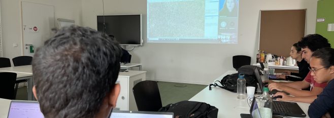
Mapathon at Institute For Geoinformatics
Nnadozie Uzoma Onyeukwu, a masters student of the Erasmus mundus master of science in geospatial
technologies organized a mapathon at Institute For Geoinformatics(IFGI), university of Munster. The
mapathon was a gathering of geospatial enthusiasts who provided open geospatial data in the United
Nations operated regions.
The mapathon was organized in collaboration with the UN Mappers, a
mapping community initiative that aims to assist UN peacekeeping missions in their field endeavors,
such as peace and security, navigation, and logistics, by providing open geospatial data to the UN
peacekeepers which helps them in tactical and operational activities.
During the mapathon, participants learnt how to contribute missing roads to the OpenStreetMap using cutting edge OSM editor like the Java Open Street Map Editor (JOSM) and explored how to edit urban and natural features used in
topographic maps in Somalia.
The mapathon saw the participation of around 20 students drawn from GEOTECH and IFGI who
contributed an inspiring 486.95km of missing roads in Somalia to the open street map for UN peace
keeping missions. The mapathon enabled participants gain insight about the peacekeeping as they made
inspiring contribution to humanitarian mapping effort in Somalia with acquired knowledge in the use of
JOSM.
The efforts of the participants of the mapathon to map missing roads in Somalia demonstrates their resolved
to make global impact towards humanitarian response.
